

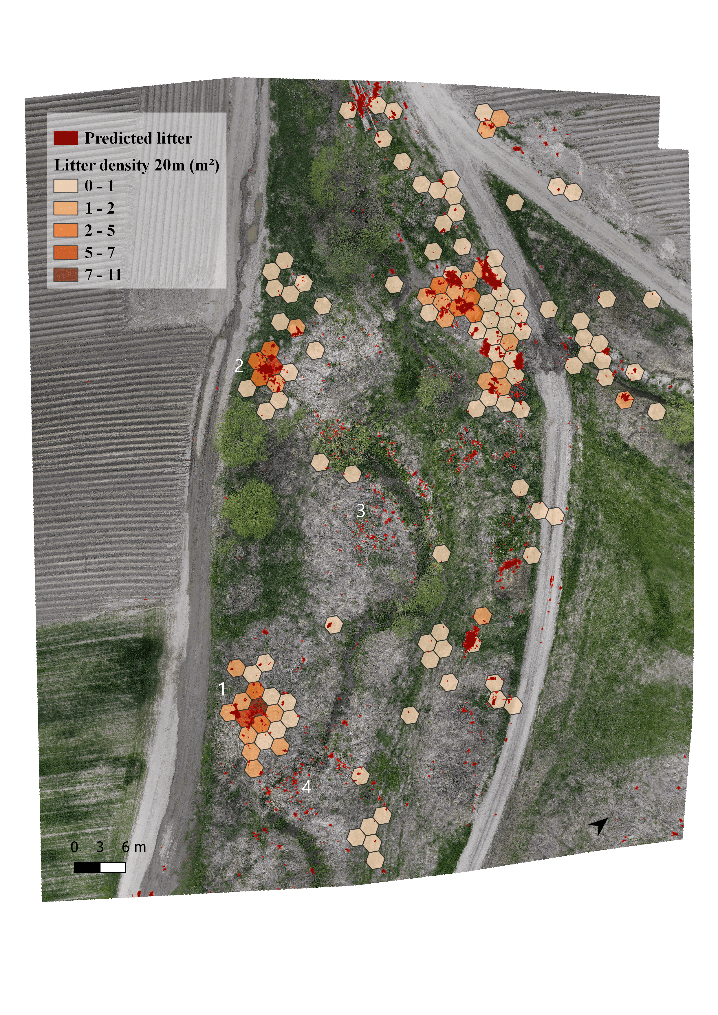
This map is part of my dissertation. The aim of my study was to identify illegal waste deposits around the settlements with UAVs at different flight heights and with different methods. I've created different rubbish categories (plastic, glass, paper, furniture waste, etc.) and I've used different methods to identify them. After using the image screening method (identifying the litter manually on ortophoto maps), I've created a density map for every flight height.
Density maps of illegal waste dumps
Tools used
AgisoftArcGIS ProQGIS
Plug-ins used
-
tags
DronelitterrubbishUAV
More by Katalin Peter


You might also like


Join the community!
We're a place where geospatial professionals showcase their works and discover opportunities.