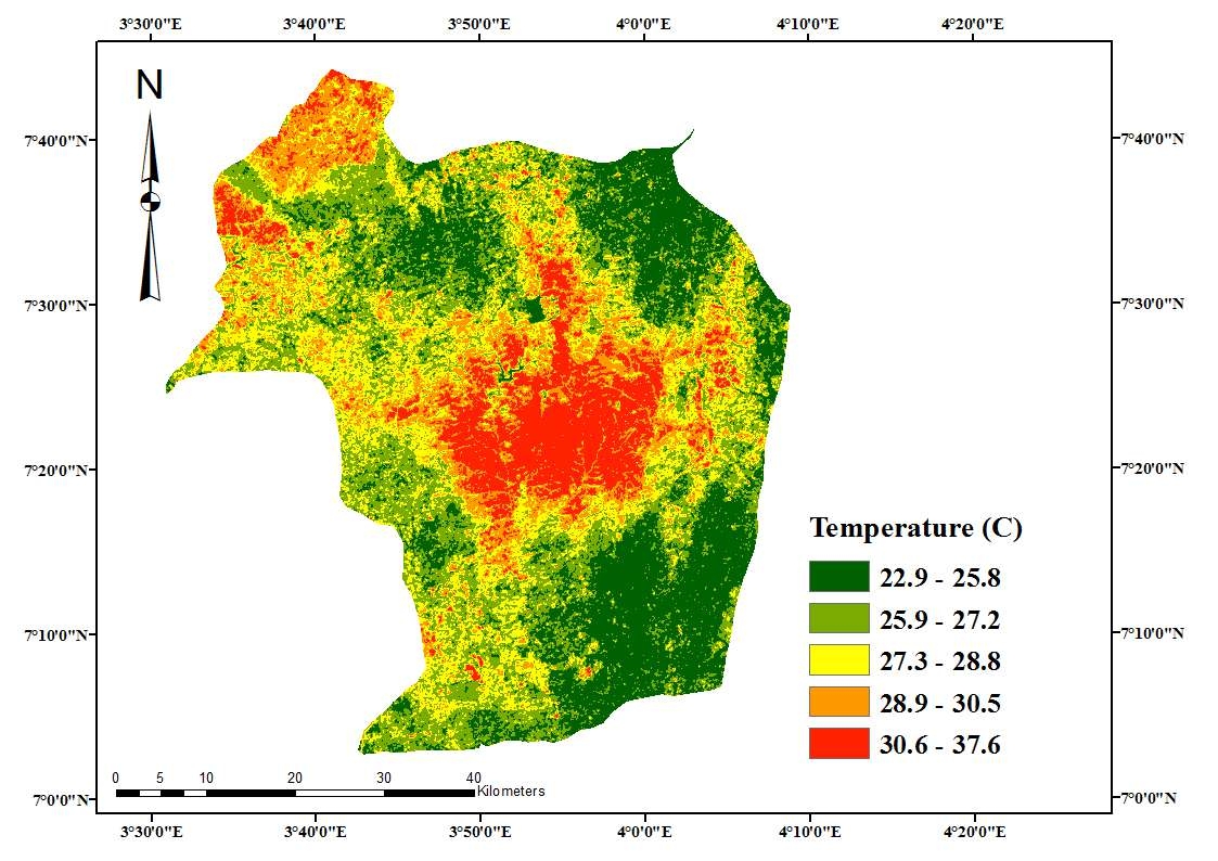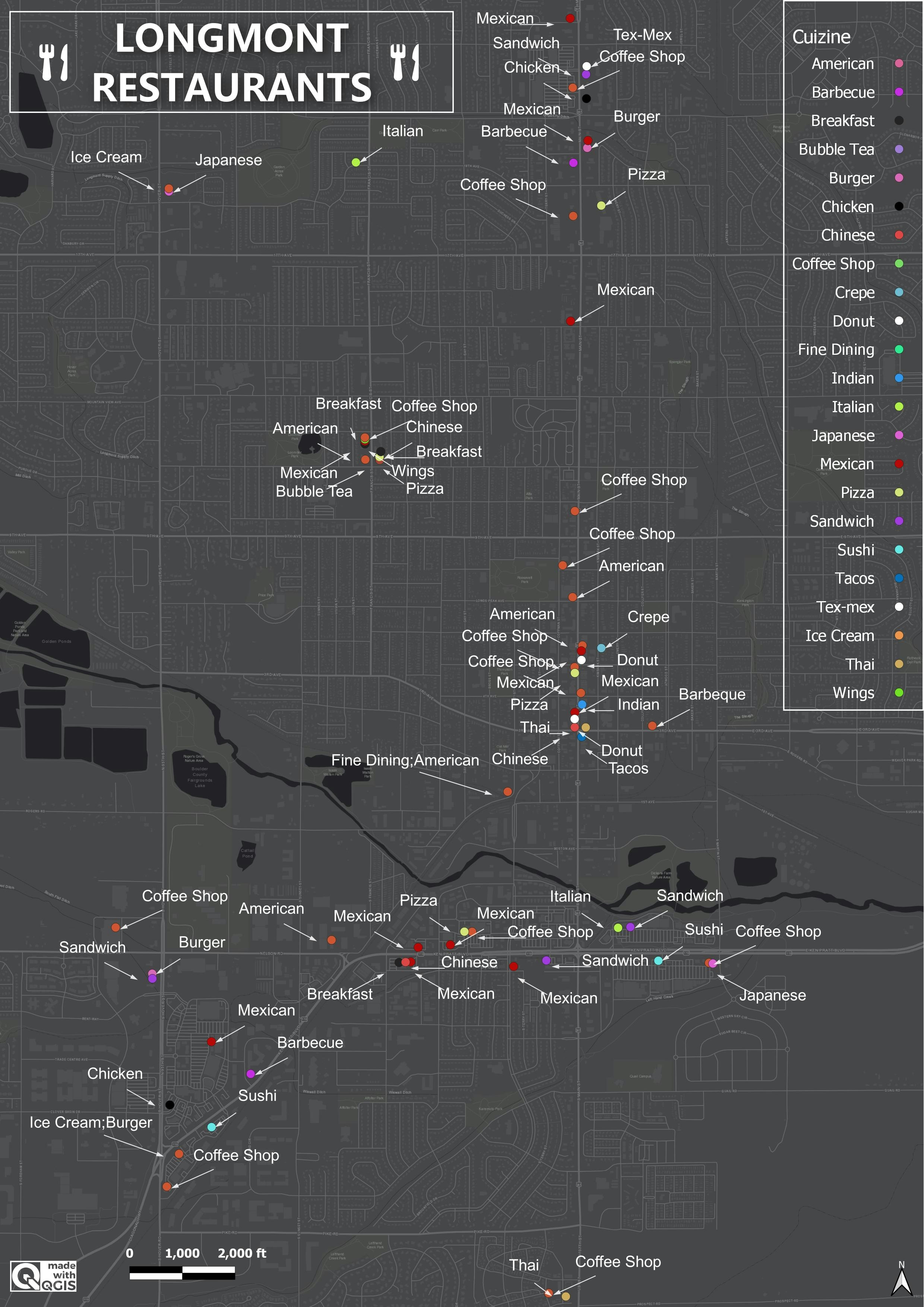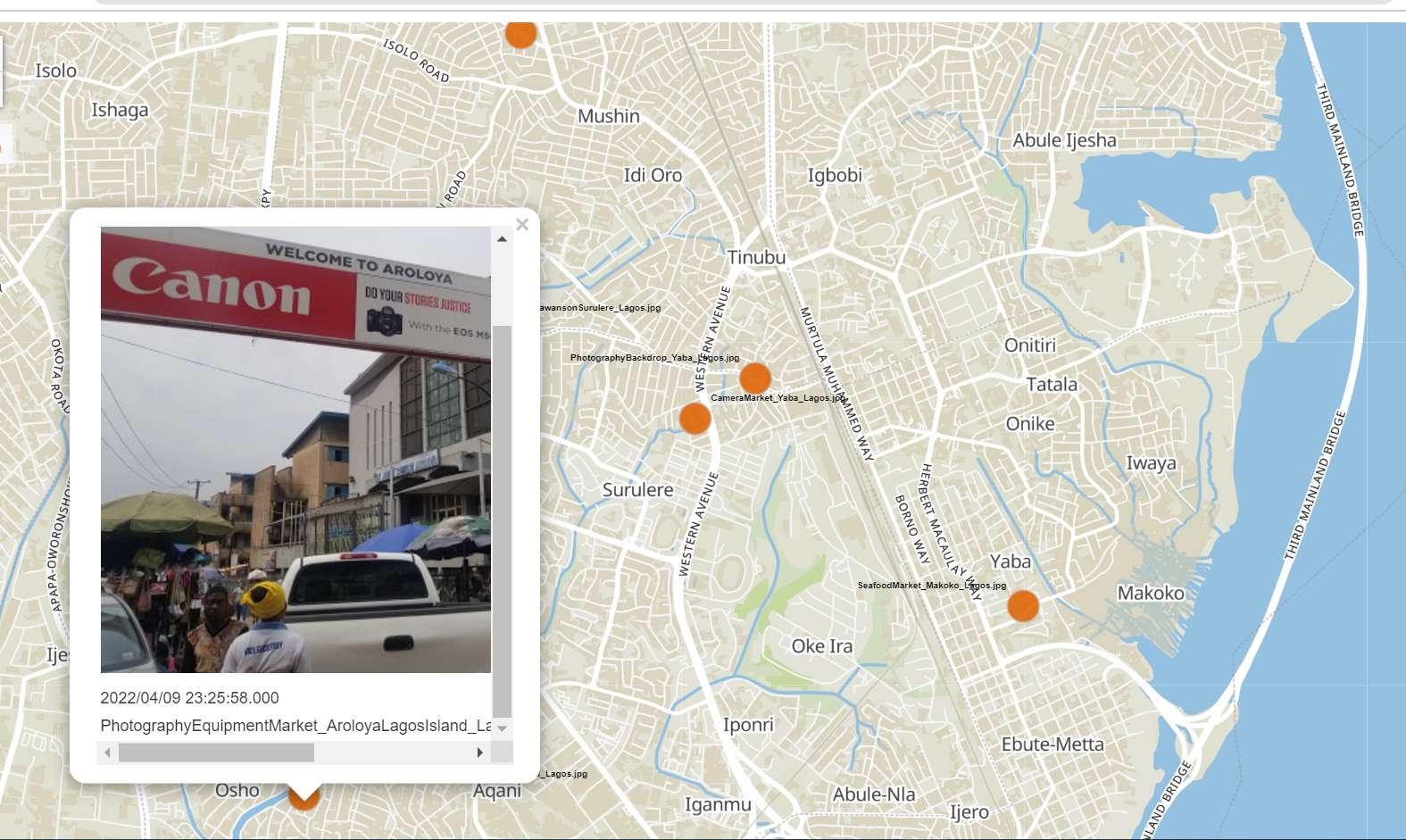
This is a web map that was made with QGIS. It shows the major markets in Lagos, Nigeria. Upon clicking any of the orange markers, it displays a picture of the market. The picture name shows the category of goods sold in that particular market.
I simply obtained the images from the internet and geotagged them using a tool called Geosetter. I geotagged the images with the coordinates of the markets and completed the rest on QGIS. This can serve as a guide to navigating Lagos market, which is a very busy one.
Read how I created the web map here