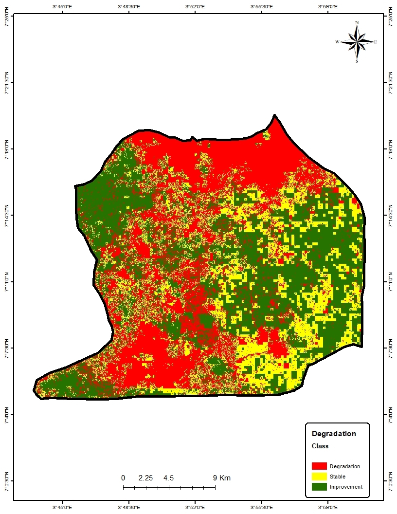
Land degradation has several negative impacts in our world today, like every other developing city in the world, the issue of land degradation and its resulting impacts is significantly high in Ibadan city. Reversing and restoring degraded lands is one of the sustainable development goals, of which the first step towards achieving this is the assessment of already degraded lands. The assessment of degraded land is a very complex task, as land degradation itself is a complex environmental issue.
To solve this problem holistically, this work, therefore, utilized geospatial technologies to assess land degradation in Oluyole LGA, with a view to identifying land degradation hotspots. The study used Landsat 8 Operational Land Imager -2020 and Landsat 7 Enhanced Thematic Mapper- 2000 to generate land cover maps, MODIS NDVI to generate Land productivity dynamics map, Soil organic carbon map to generate Soil organic carbon trends. Land degradation was assessed by the combination of these data as indicators of land condition.
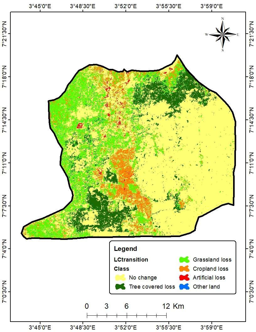
The land degradation map showed that 239.9, 137.7, 234.0 km2 land area improved, land area stable and land area degraded respectively. Most lands degraded areas are built-ups where forest and vegetated lands have been converted to built up.