Land use maps were produced using the random forest classification algorithm was chosen ahead of other classification algorithms as a result of its enhanced accuracy, classification algorithm, while performing a supervised classification method.
To classify the images, the Landsat series was used with 30m spatial resolution, the blue, green, red, and near-infrared bands were used to create a true and false colour composite. The composite was one of the image enhancement techniques to ensure visual recognition of the different land cover features on the surface while training the data in a supervised method.
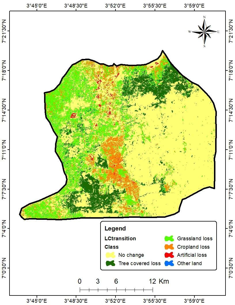
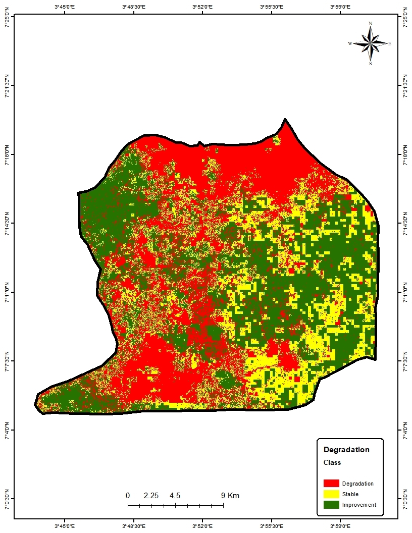
Between the initial and final years of study, land use and land cover types have dynamically transitioned from one to another, such as the conversion of forests to built-ups and bare surfaces. Land cover dynamics study can be used to infer the effect of population growth and urban sprawl on the environment.


.jpeg&w=3840&q=100)