

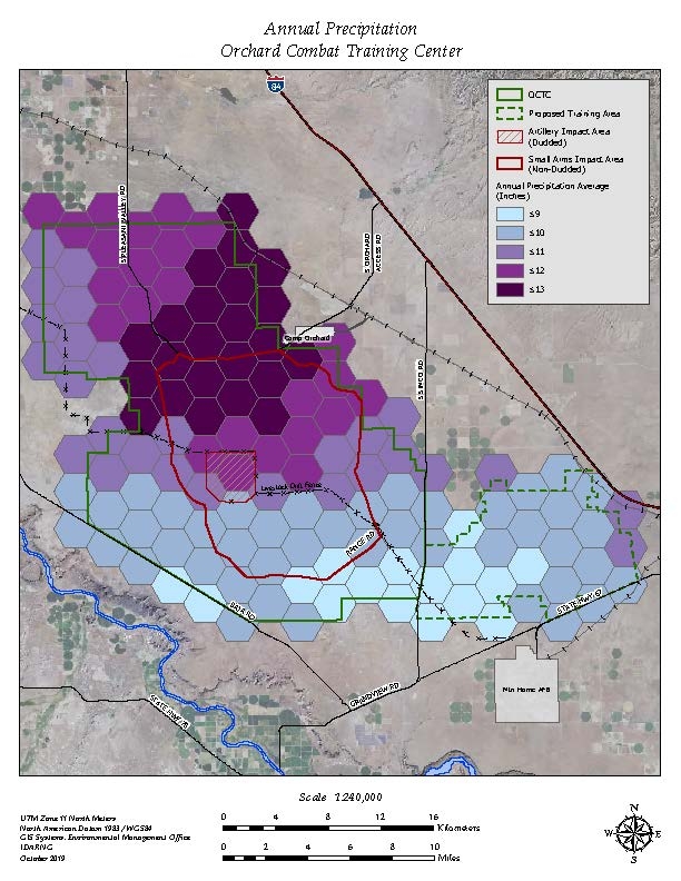
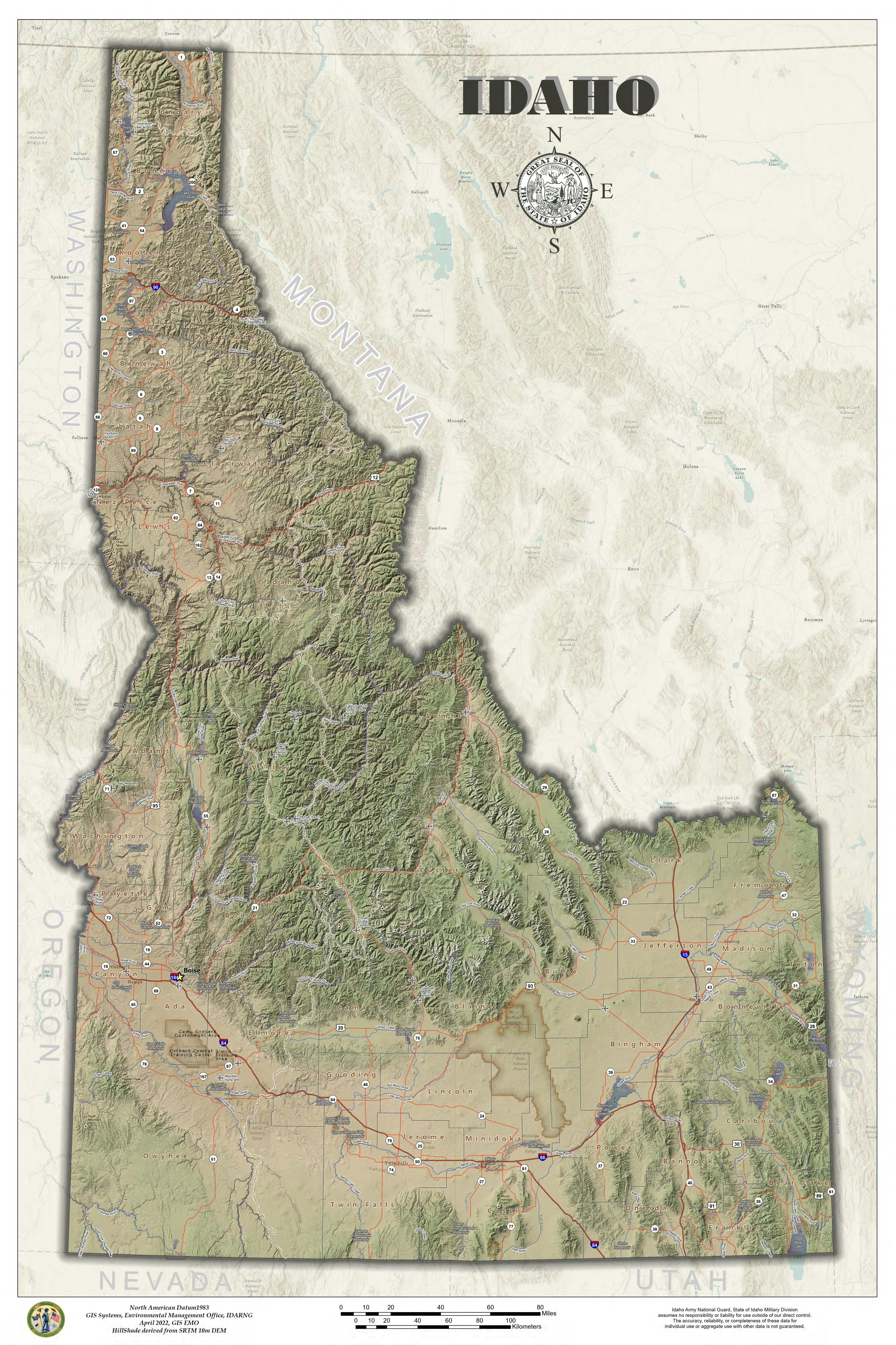
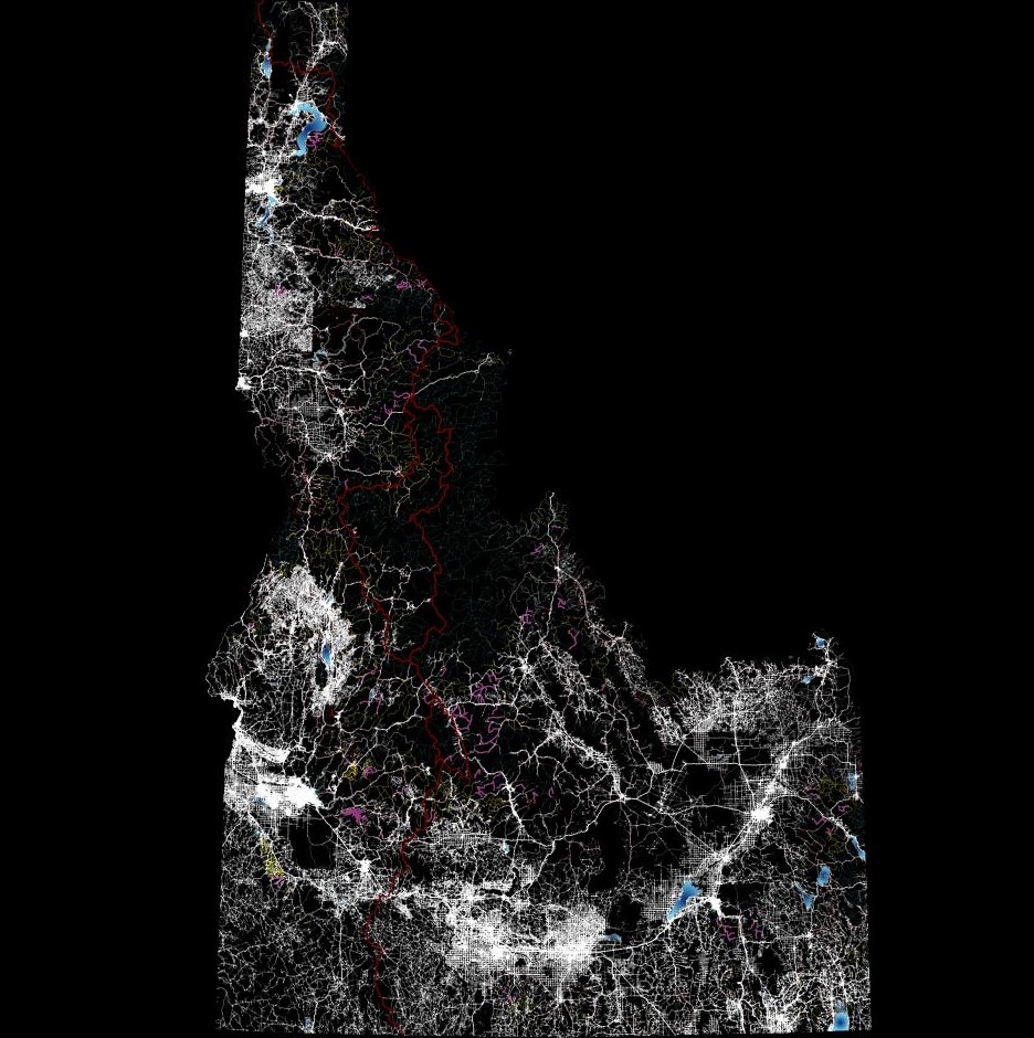
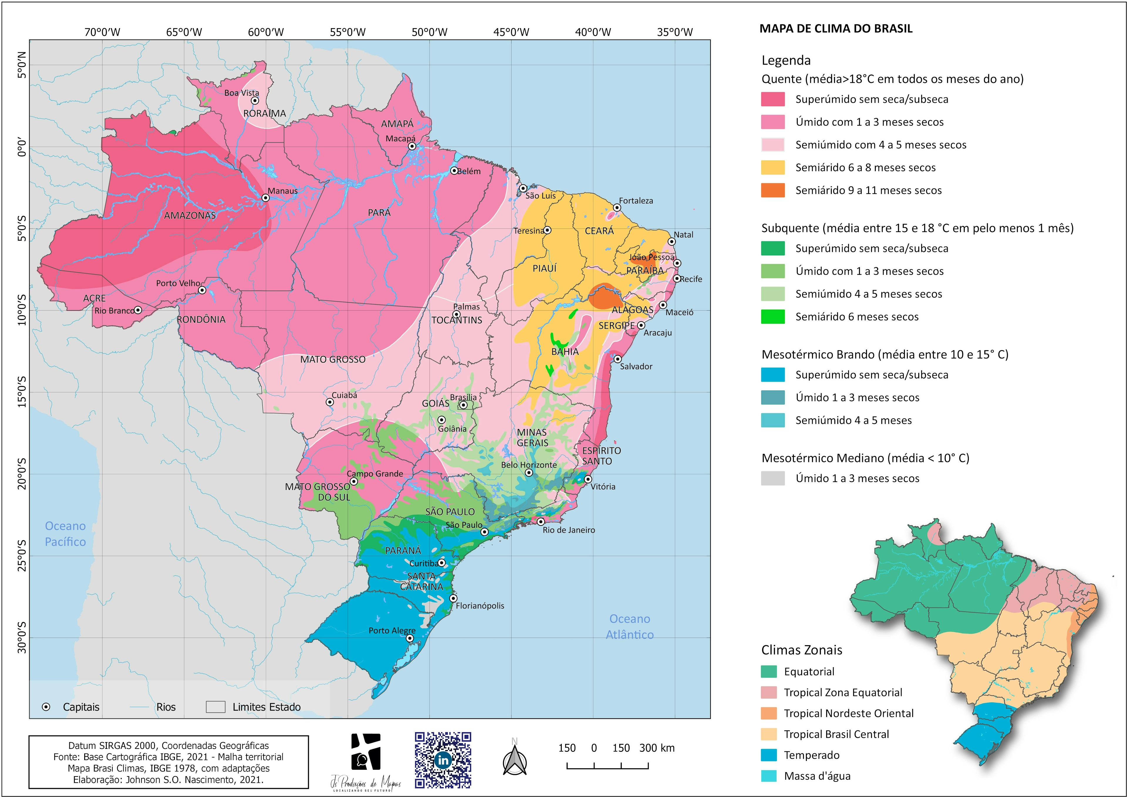
Using LIDAR, created a flow analysis. Then blended elevation color ramp with Imagery. Overlayed a multi-level transparent hill shade
Surface Drainage
Tools used
flowdirectionHill
Plug-ins used
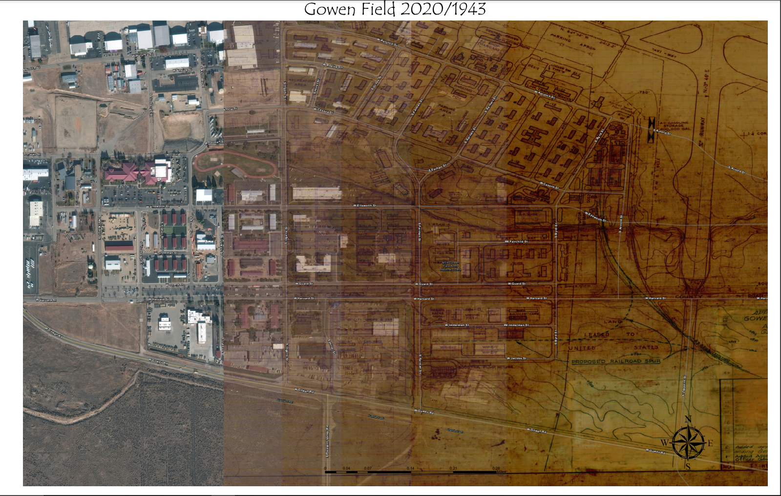
Surface Difference
tags
ElevationhillshadeIdahoSurface drainage
More by Michael Nau


You might also like
.svg "Keran Nkongolo")


.png&w=3840&q=100)
 He")
Join the community!
We're a place where geospatial professionals showcase their works and discover opportunities.