
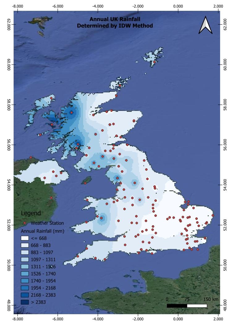
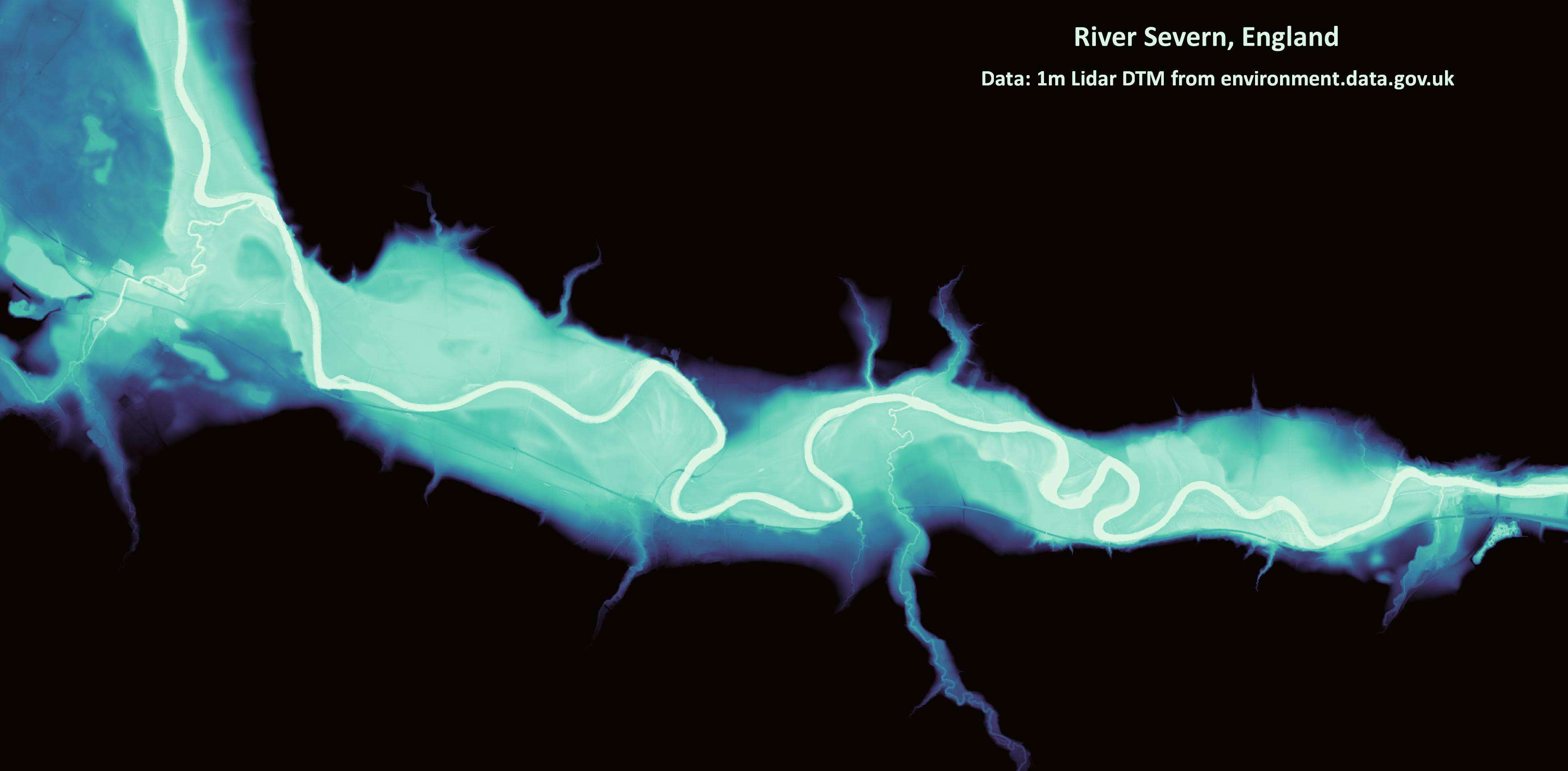
Data from UK rainfall measuring weather stations
IDW Interpolation method used
UK Annual Rainfall Map
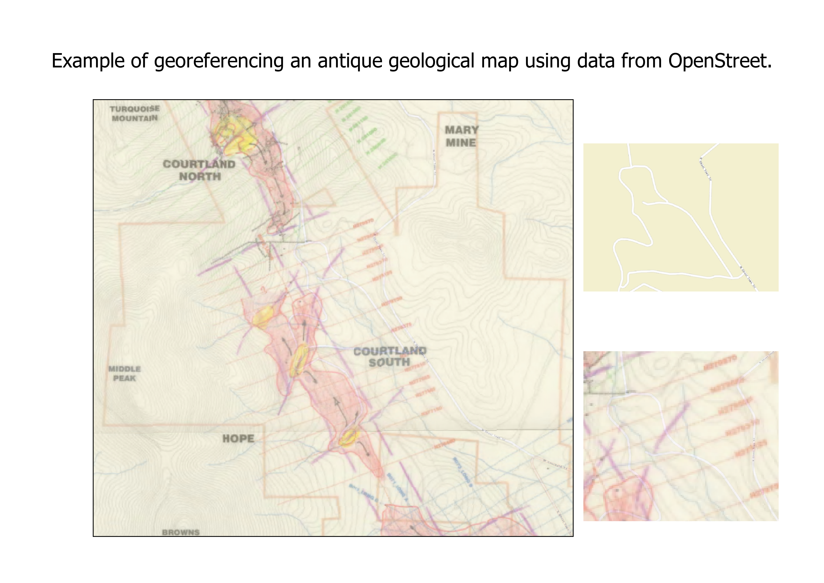
Plug-ins used
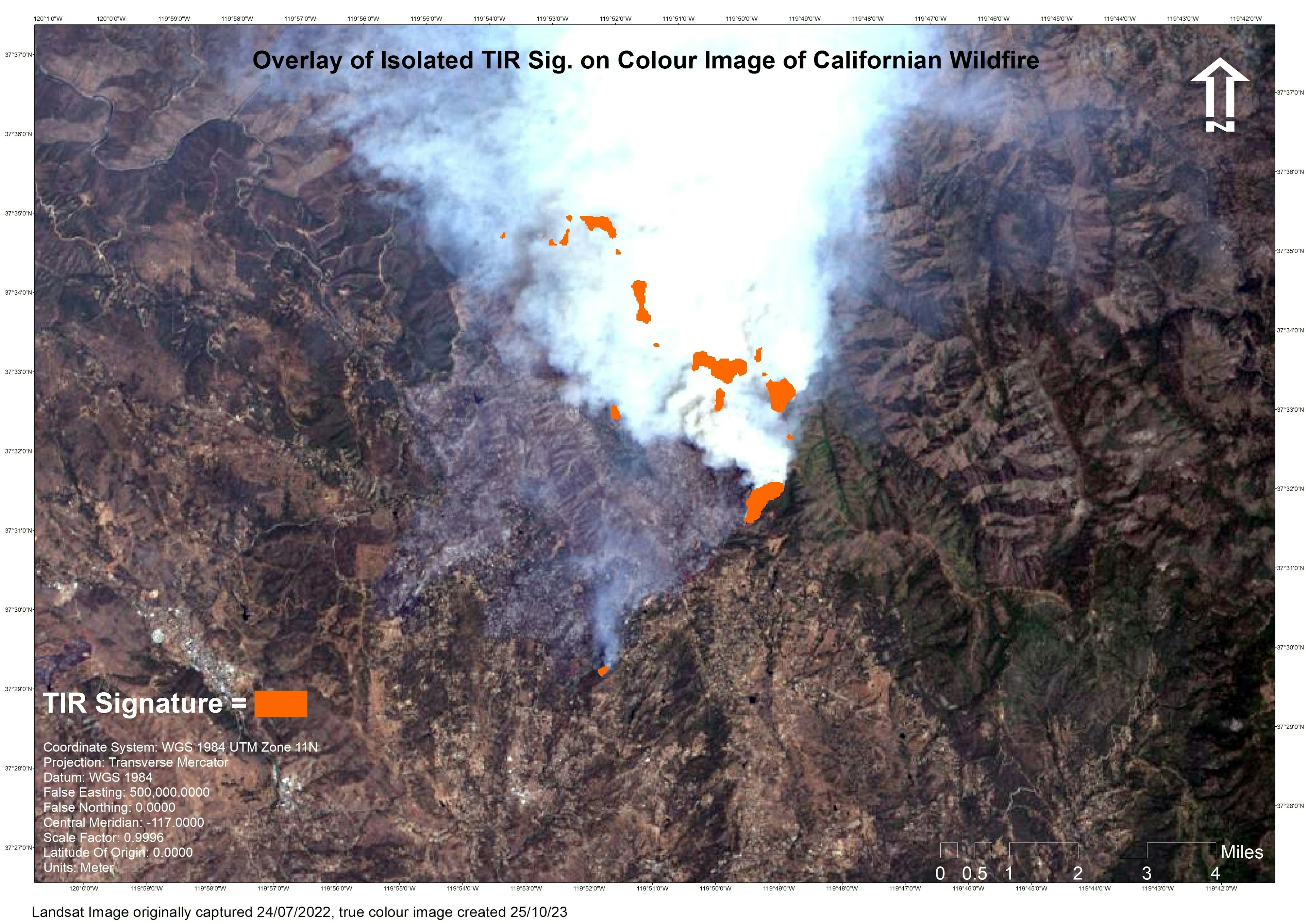
Landsat
tags
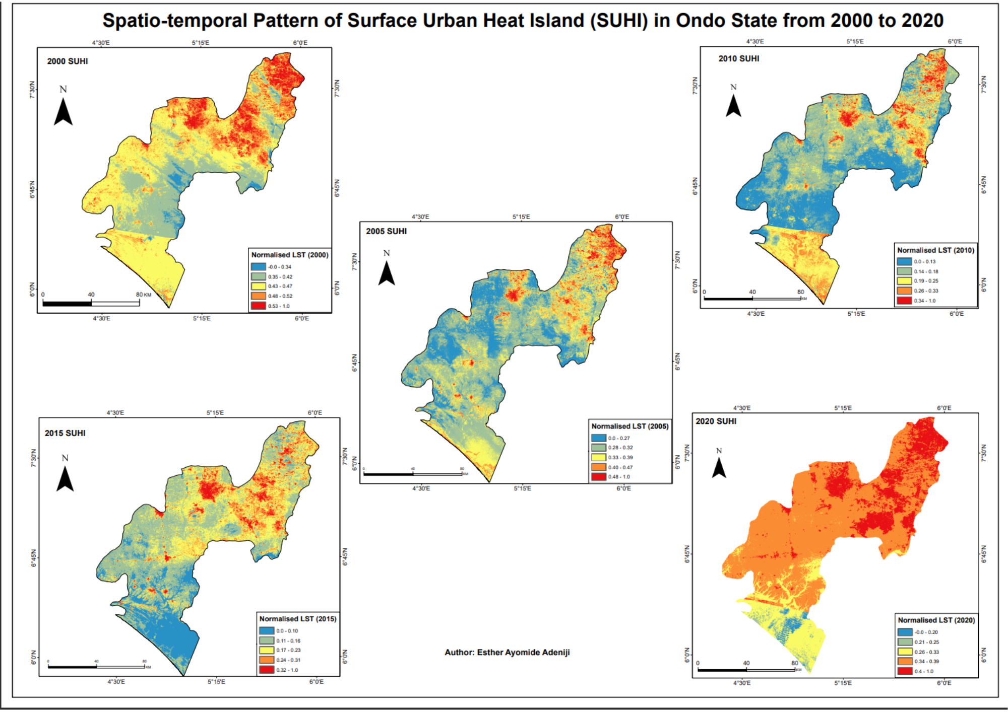
Rainfall
More by Cameron


You might also like


Join the community!
We're a place where geospatial professionals showcase their works and discover opportunities.