
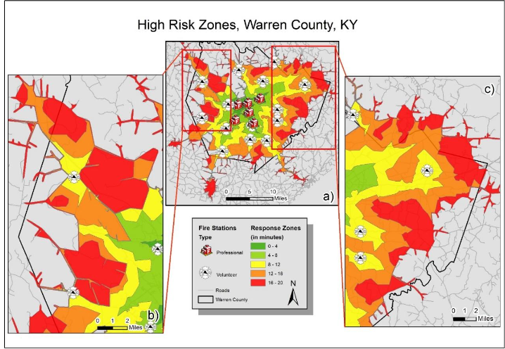
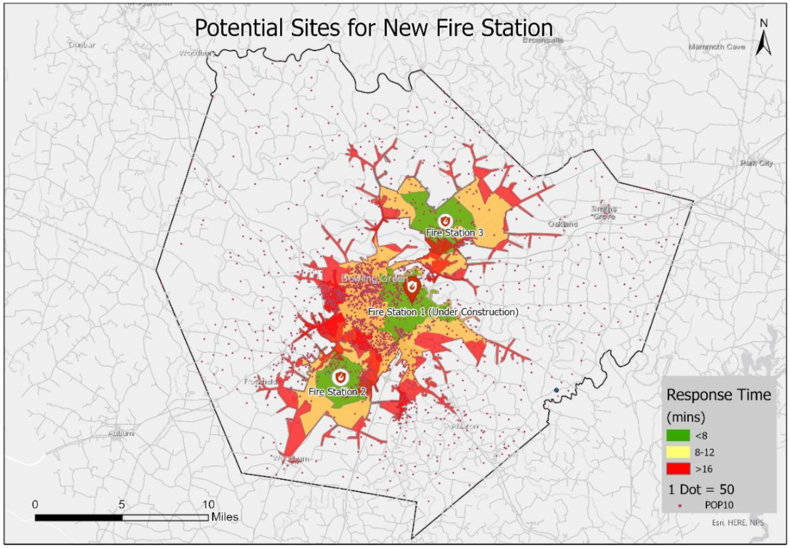
Fire stations are crucial urban land uses directly related to the well-being of residents in terms of life and property safety. Assessing the response time of existing fire stations is important to determine the level of protection provided to people and property. In Warren County, Kentucky, a study was conducted to assess the performance of existing fire stations and their response time using the ArcGIS environment. The results revealed that approximately 85% of the total population is under excellent to fair protection, with response times ranging from 0 to 12 minutes. Around 7% of the population is under poor protection, experiencing response times of 12 to 16 minutes. Moreover, 3% of the population falls under very poor protection, facing response times of 16 to 20 minutes, while 5% of the population has no protection, enduring response times of 20 minutes or more.
Fire Station Response Time
Tools used
Aerial ProportionArcGISNetwork Analysisservice area analysisSpatial analyst
Plug-ins used
Network AnalysisSpatial Analyst Toolbox
tags
Fire Station, Network Analyst, Spatial Analyst
More by Niroj Shrestha
You might also like


Join the community!
We're a place where geospatial professionals showcase their works and discover opportunities.