
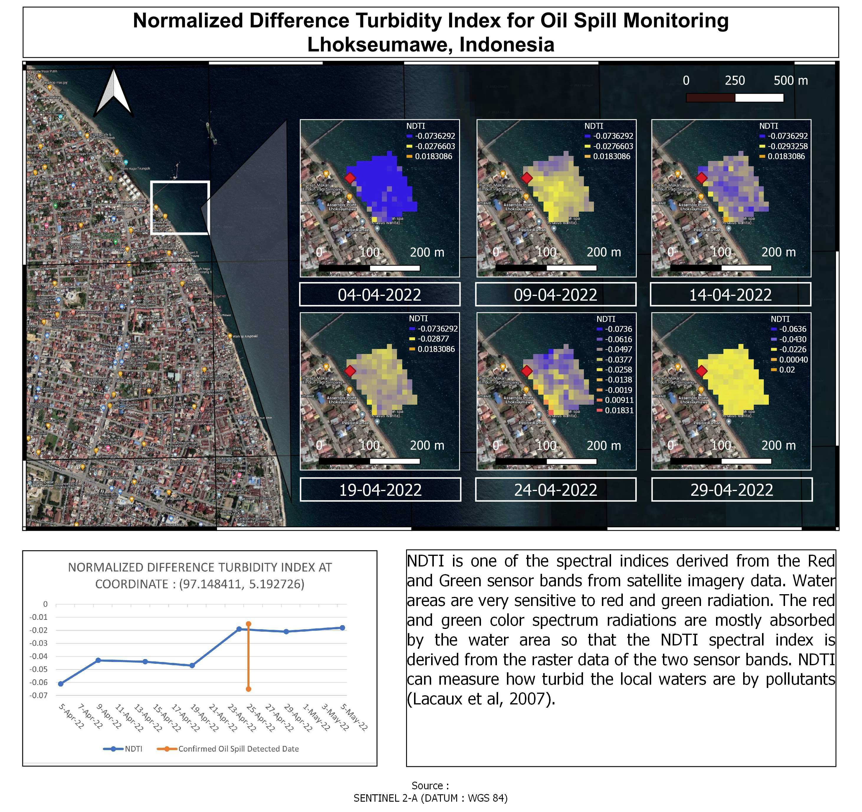
This study provides new insights for monitoring oil spills in seawater. NDTI is derived from red and green raster data of Sentinel 2A using Google Earth Engine (for the batch process). NDTI is spectral indices derived from the Red and Green sensor bands from Sentinel 2A satellite imagery data. Water areas are very sensitive to red and green radiation. The red and green color spectrum radiations are mostly absorbed by the water area so that the NDTI spectral index is derived from the raster data of the two sensor bands. NDTI can measure how turbid the local waters are by pollutants (Lacaux et al, 2007).
Oil Spill Monitoring - Lhokseumawe
Tools used
Google Earth Engine(GEE)Microsoft ExcelQGIS
tags
Google Earth Engine(GEE)QGISRemote Sensing
You might also like


Join the community!
We're a place where geospatial professionals showcase their works and discover opportunities.