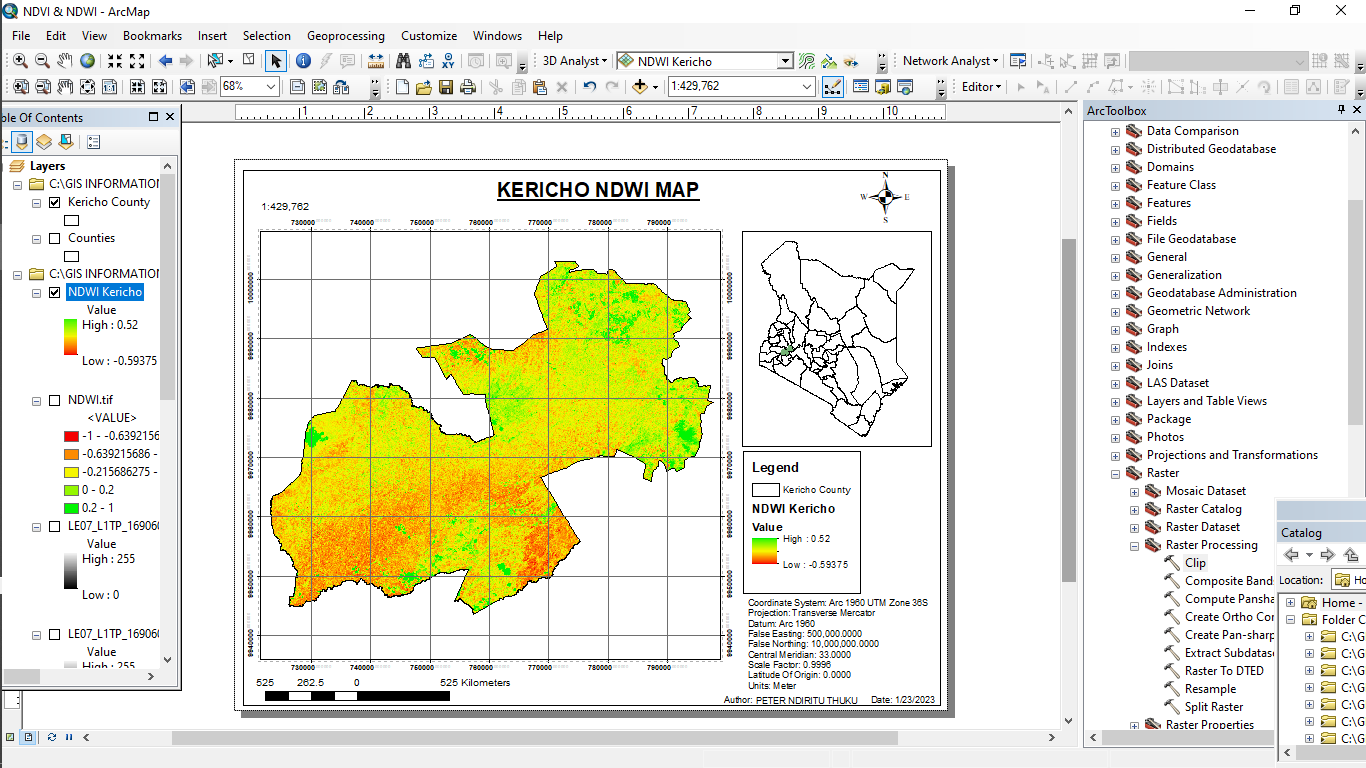
Classifying land use and land cover on Google Earth Engine within Kiambu County in Kenya can be done using a combination of remote sensing data and machine learning algorithms. This involves accessing satellite imagery available on the Google Earth Engine platform, such as Landsat or Sentinel, and applying image processing techniques to extract meaningful information about the land surface.
The classification process typically involves training a machine learning algorithm, such as Random Forest or Support Vector Machines, using labeled data to differentiate between different land use and land cover classes. The labeled data can be collected through field surveys or by using existing ground truth data sources.
To classify land use and land cover in Kiambu County, it is essential to define the classes of interest, which may include urban areas, forests, agricultural land, water bodies, and other land cover types. The spectral signatures of each class can be extracted from the satellite imagery and used to train the machine learning algorithm.
Once the algorithm is trained, it can be applied to the entire study area, and the resulting land use and land cover map can be validated and refined using ground truth data. The final map can be used to monitor land use changes over time, assess the impact of land use policies, and support land management decision-making.