
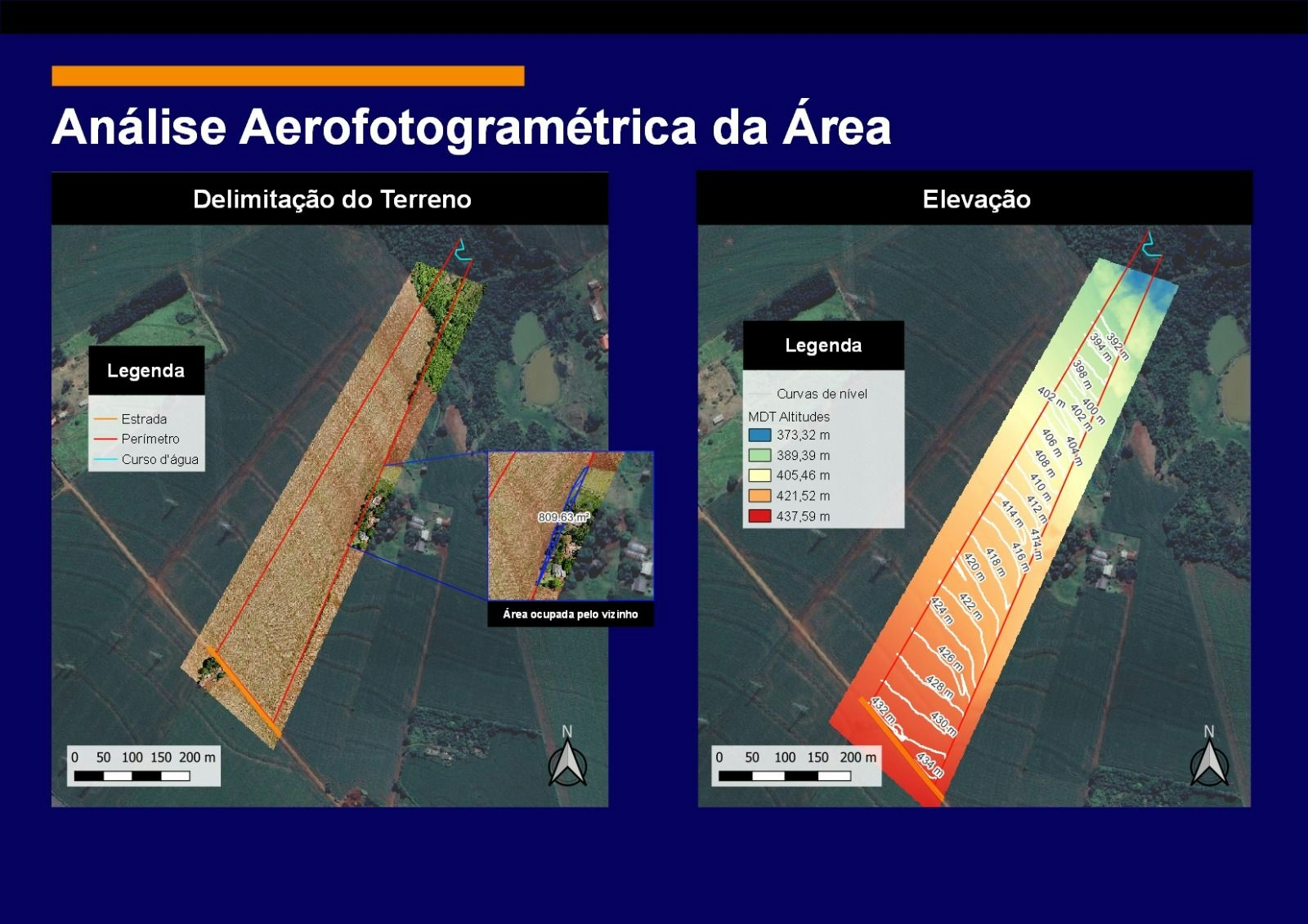
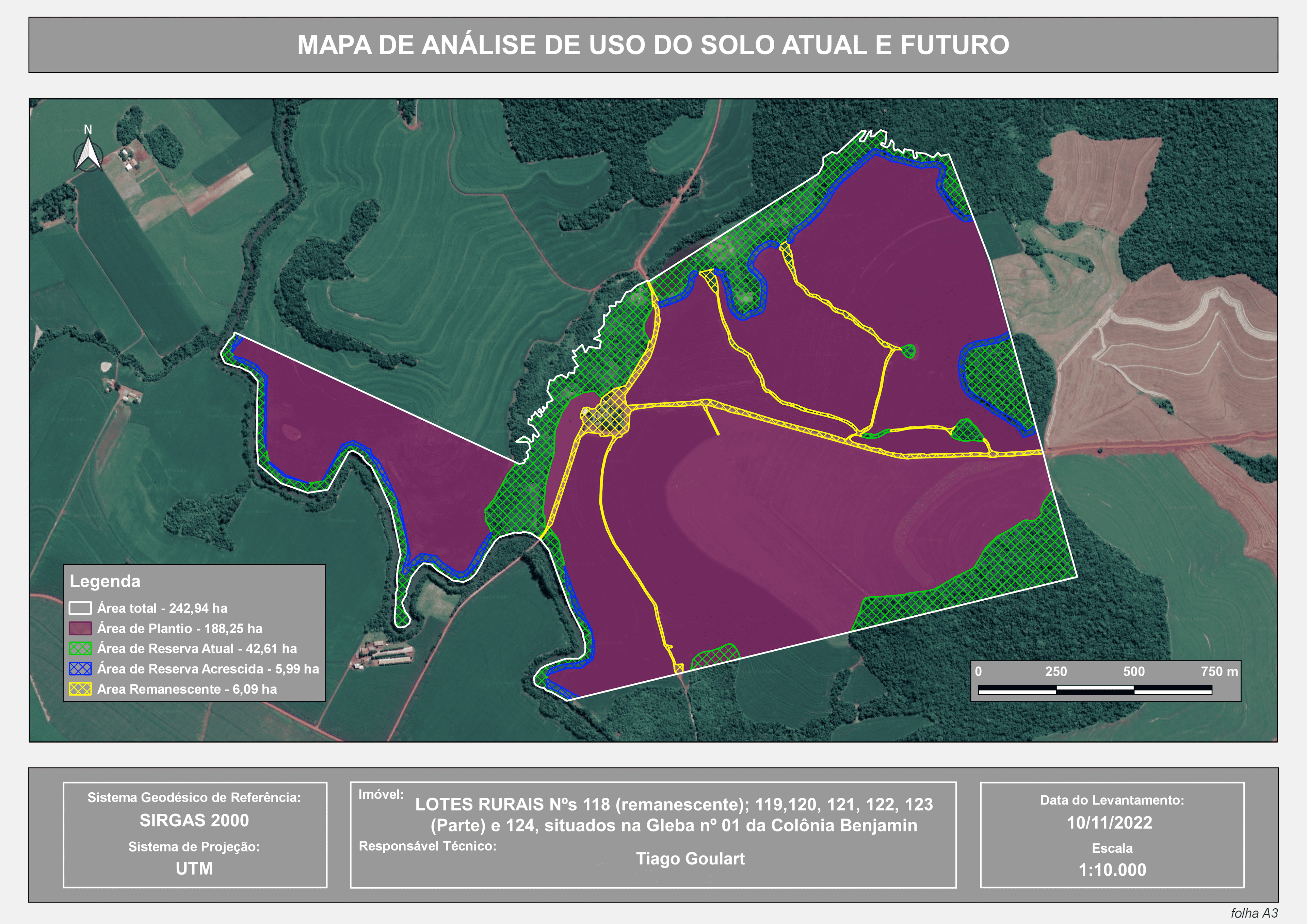
The following map presents a drone-generated image along with an analysis of a rural property, highlighting a discrepancy in boundary delineation. The map clearly indicates the extent of encroachment by the neighboring property. Additionally, a planimetric analysis was conducted, resulting in contour lines and a digital terrain model that represents altitude variations. This comprehensive analysis was carried out using QGIS, Open Drone Map, and DroneLink, which are essential tools in the field of Geographic Information Systems (GIS)
General analysis about rural property
Plug-ins used
Contour LinesgeoreferencerQuickMapServices
tags
Digital Elevation ModelGNSSimagery analysis
More by TIAGO LANDIM GOULART DE OLIVEIRA


You might also like


Join the community!
We're a place where geospatial professionals showcase their works and discover opportunities.