Sign up or log in to your Spatialnode account.

Takes less than a few seconds.

Geological Map Digitalization

Martin Nuñez Igarzabal
Martin Nuñez Igarzabal•

May 08, 2023

Geological Map Digitalization

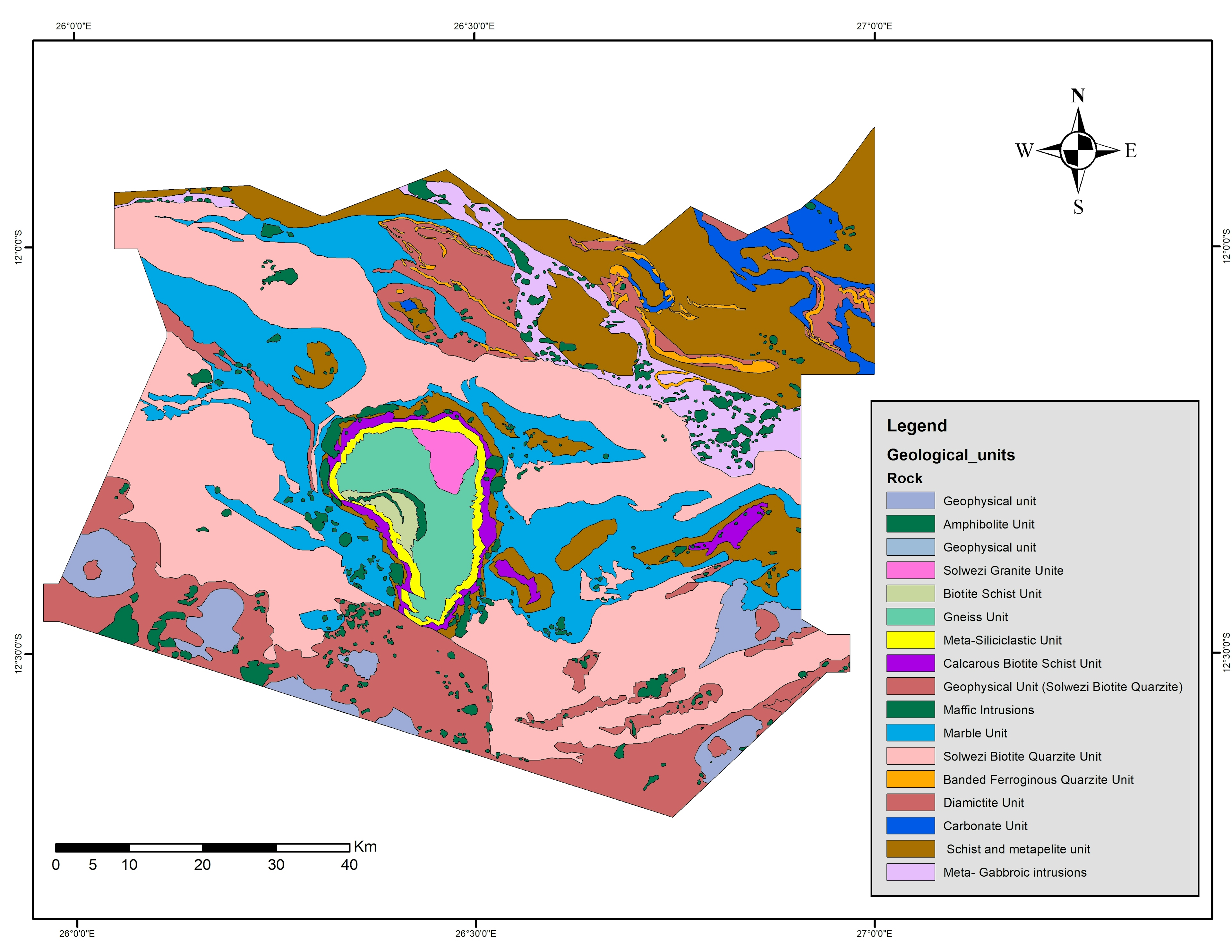
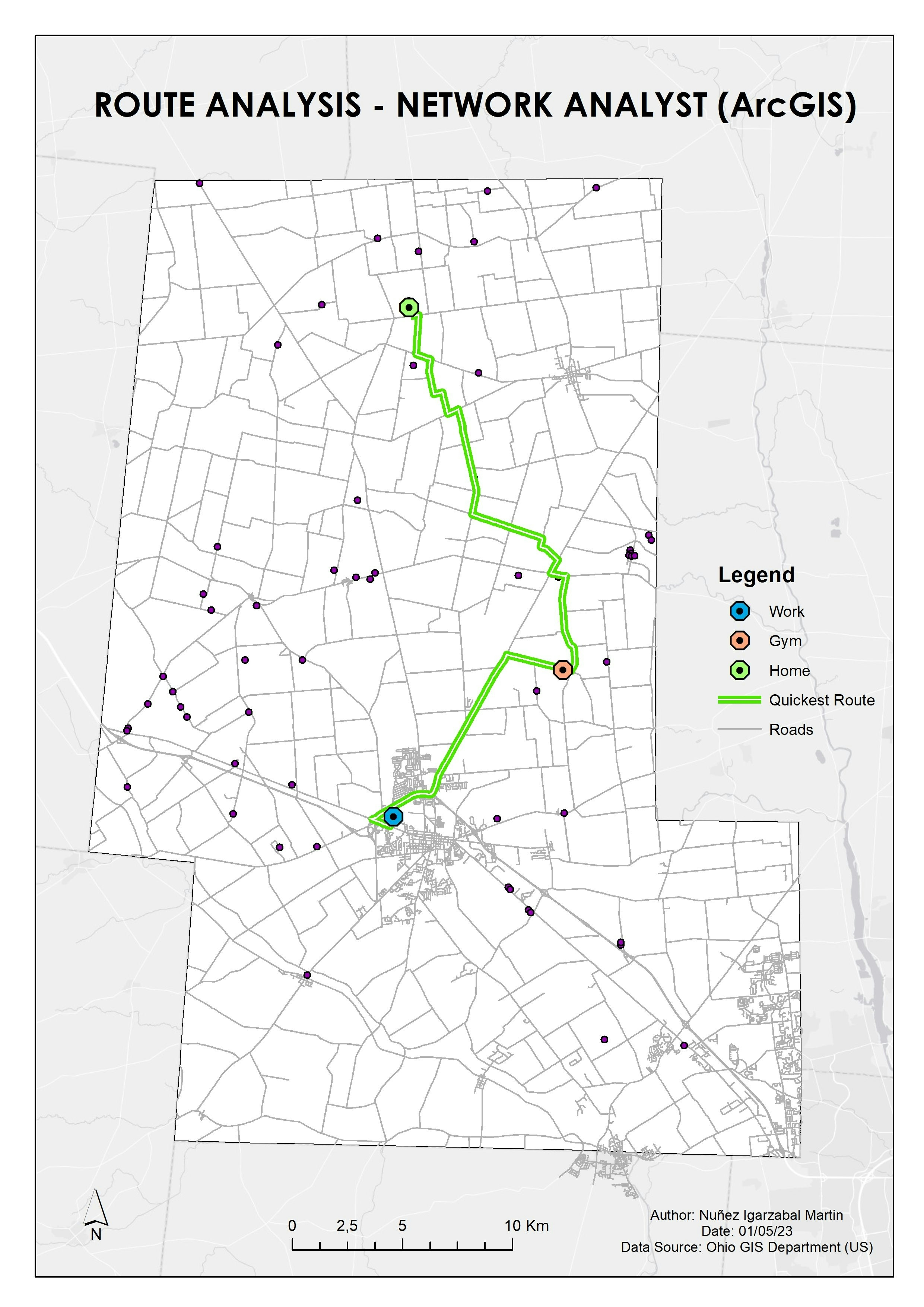
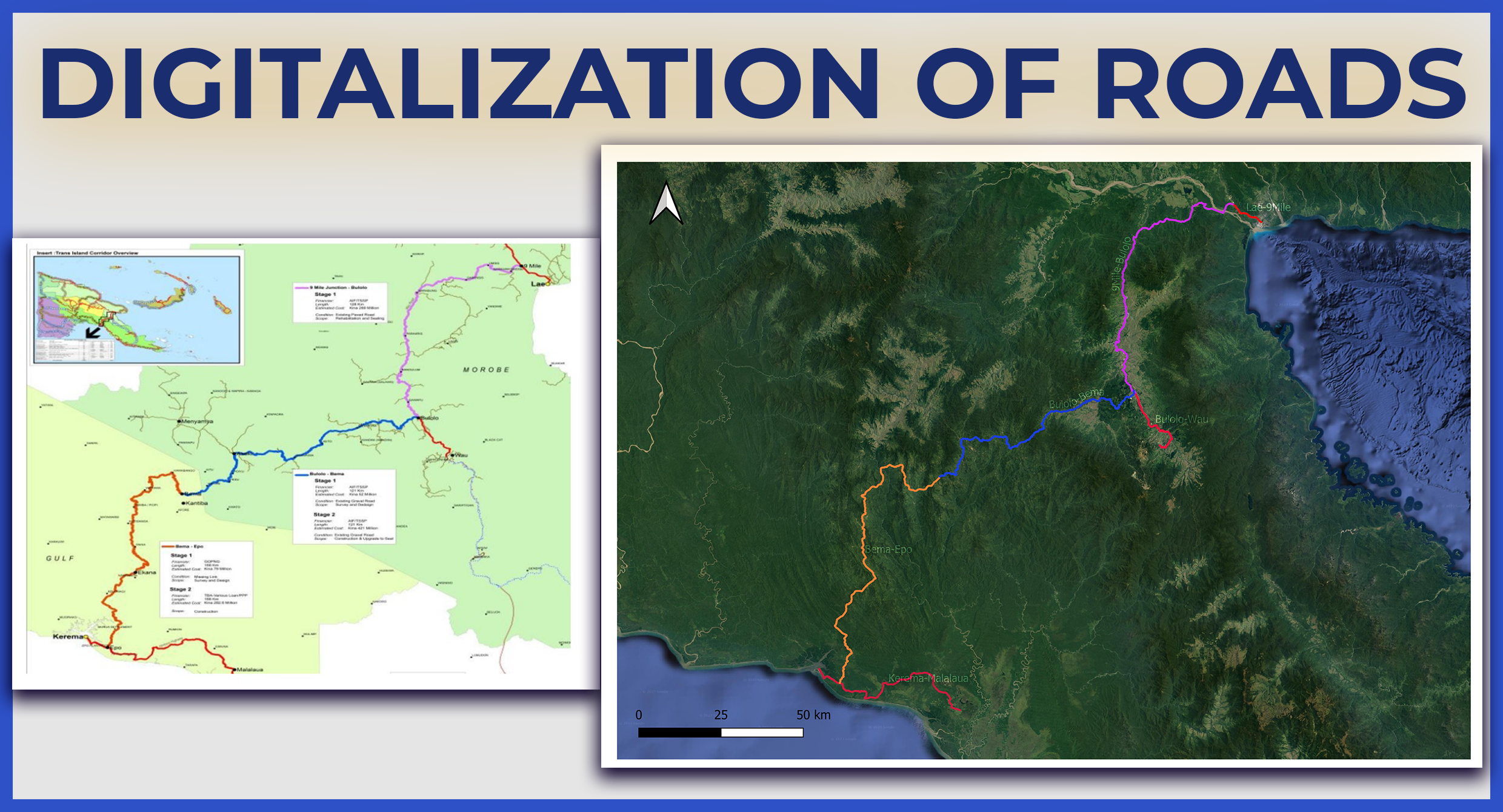
Digitalization of geological units based on a georeferenced raster. Made by using QGIS


Tools used

Adobe IllustratorQGIS

Plug-ins used

georeferencerQGIS

tags

digital image processingGeologyGIS

More by Martin Nuñez Igarzabal

Digitalization of roads - New Guinea
5
Drive Time Areas Map
11
QGIS Map (Southern Europe)
51
Voting data in California
20
Infographic Map - Mining Company
13
Digital Elevation Model - Buenos Aires
67
Population Density Map of Arkansas
54
Spatial Analysis - Drive time (QGIS Map)
21
Route Analysis (ArcGIS Network Analyst)
23
Temperature Heat Map - Argentina
41
ArcGIS Map (Ozone concentration)
18
Population Heat Map - Arkansas
47

You might also like

2019-2023 Global Covid-19 Dashboard
Oladeji Muhammed
2019-2023 Global Covid-19 Dashboard
Oladeji Muhammed
30
Data presentation on waste collection
Lawrence Akpoterai
Data presentation on waste collection
Lawrence Akpoterai
28
mapa de localização
Edmundo C S Junior
mapa de localização
Edmundo C...
14
Washington WF Over 1 Acre
Keran Nkongolo
Washington WF Over 1 Acre
Keran NkongoloPro
9
Air Pollution and Population Trends
erica chaif
Air Pollution and Population Trends
erica chaif
11
Idaho Pasture land and Beef Cows
Keran Nkongolo
Idaho Pasture land and Beef Cows
Keran NkongoloPro
17
Mapa Hipsométrico de Pedra Branca - CE
Maria De Fátima Alves De Freitas
Mapa Hipsométrico de Pedra Branca - CE
Maria De...
14
Akure Temperature Map (1984 and 2020)
Ojo Aladesola Monica
Akure Temperature Map (1984 and 2020)
Ojo Aladesola Monica
19
Florida DEM
John Parker Dinkins
Florida DEM
John Parker Dinkins
57
Analizing camera trap results
Angela Mejia
Analizing camera trap results
Angela Mejia
14
Map of Asaba and Cultural Sculptures
Elizabeth Ugwu
Map of Asaba and Cultural Sculptures
Elizabeth Ugwu
5
Pedestrian Infrastructure mapping
Okiki Akinboyewa
Pedestrian Infrastructure mapping
Okiki Akinboyewa
6

Join the community!

We're a place where geospatial professionals showcase their works and discover opportunities.

Sign Up for free