Sign up or log in to your Spatialnode account.

Takes less than a few seconds.

Lights Heatmap 🌃

Alexa Cristina
Alexa Cristina•

February 11, 2022

Lights Heatmap 🌃

Population density combined with lights heatmap.

Data: GPW v4, NOAA Average Lights X Pct, ASTER GDEM

Inspired by:Population Density at Night
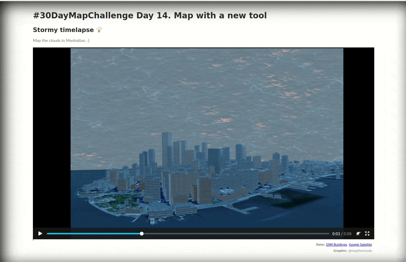
Demo

Tools used

QGIS

Plug-ins used

SAGA GIS

tags

ASTERGDEMNOAAQGISSAGA GIS

More by Alexa Cristina

A furry journey 🐾
A furry journey 🐾
77
The many faces of elections - Cartograms
52
Dancing City
Dancing City
27
The Hexagonal Nose ⬡⬡⬡
3
Earth in Blender 🌎
Earth in Blender 🌎
94
Moon 🪨
Moon 🪨
46
Projected Time Zones 🌐
38
Yosemite Valley ⛰️⛰️
127
Cluj County
Cluj County
15
Population per administrative units Map
22
People Constellations ✨
42
Multiple and Flexible Pathways
154

You might also like

Figura de Uso e Ocupação do Solo - UHECN
Leonardo Ruschel Horn
Figura de Uso e Ocupação do Solo - UHECN
Leonardo Ruschel Horn
6
Environmental Zoning
rafael menezes de souza
Environmental Zoning
rafael menezes...
44
Andalucia NDVI (1997 to 2000) #30DayMapChallenge #SpatialNode #NDVI #Day10 #Raster
Marcelo Aguilera
Andalucia NDVI (1997 to 2000) #30DayMapChallenge #SpatialNode #NDVI #Day10 #Raster...
Marcelo Aguilera
492
Spatial Interpolation
omoogun bankole
Spatial Interpolation
omoogun bankole
8
Surface Drainage
Michael Nau
Surface Drainage
Michael Nau
87
Spatial Distribution of Wildfire- Canada
Shukurah Dhupe Alabi
Spatial Distribution of Wildfire- Canada
Shukurah Dhupe Alabi
68
Mapa Pré-Exploratório em AMF
Marina Martins de Almeida
Mapa Pré-Exploratório em AMF
Marina Martins...
21
Data Dev - Bat Conservation Strategy
Jeffrey Erwin
Data Dev - Bat Conservation Strategy
Jeffrey Erwin
10
Remote Sensing of Orchard
Reese Dresch
Remote Sensing of Orchard
Reese Dresch
27
Canopy Height Model, Selby, UK
Adriana Calderon
Canopy Height Model, Selby, UK
Adriana Calderon
94
Map of the Niger-Delta area of Nigeria
Paul Ugbong
Map of the Niger-Delta area of Nigeria
Paul Ugbong
217
Índice de Vegetação - NDVI
Carlos Joubert Sousa da Rocha
Índice de Vegetação - NDVI
Carlos Joubert...
198

Join the community!

We're a place where geospatial professionals showcase their works and discover opportunities.

Sign Up for free